6 BRIAR RD
Owner Information
SZCZEBAK RICHARD A & PATRICIA
6 BRIAR RD
CANTON, MA 02021


Property Details
6 BRIAR RD is classified as a Single Family Residential (Colonial).
The primary structure on this property was built in 1992. There are 2,987ft2 of built area within this property. There is 2,987ft2 of residential/living space within this property. This property is listed as having 8 rooms.
6 BRIAR RD is valued at $762,400. The land is valued at $277,200 and the structures are valued at $485,200.
This property is in Zone SRB. Confirm with local Zoning Board authorities to ensure there are no overlays or other easements on this property.
The most recent deed for 6 BRIAR RD is recorded at the local registrar in Book 10074, Page 658. 6 BRIAR RD was last sold on Tuesday, August 31, 1993 for $273,000.
Assessment data from fiscal year 2022.
Flood Data
According to the FEMA National Flood Hazard Layer, this property does not appear to be in a flood zone. It may also be in an area not yet reviewed. Nonetheless, confirm this information prior to taking any action.
To view the flood hazards around this property, create a FEMA "Firmette" Map of the area around 6 BRIAR RD.
Broadband Internet Providers
| Provider | Type | Bandwidth (mbps) | |
|---|---|---|---|
| GCI Communication Corp. | Satellite | 0 | 0 |
| HughesNet | Satellite | 25 | 3 |
| Viasat Inc | Satellite | 100 | 3 |
| Verizon New England Inc. | Fiber | 940 | 880 |
| Comcast | Cable | 1000 | 35 |
| VSAT Systems, LLC. | Satellite | 2 | 1 |
Broadband service provider data from December 2020.
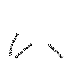
Adjacent Properties
- 61 OAK RD
Single Family Residential owned by GUENTHNER MARK & CAROL A (TBE) - 69 OAK RD
Single Family Residential owned by 69 OAK ROAD REALTY TRUST - 71 OAK RD
Single Family Residential owned by DONLAN FAMILY IRREVOCABLE TR - 71-A OAK RD
Single Family Residential owned by RAGUSA GAIL R - 8 BRIAR RD
Single Family Residential owned by BERKOWITZ KENNETH & - 4 BRIAR RD
Single Family Residential owned by JOSEPH SARA